GradePlane LandGrading Design 1.80

Latest update

December 27, 2025

License Price

Price on Request

OS

Windows

GradePlane LandGrading Design 1.80


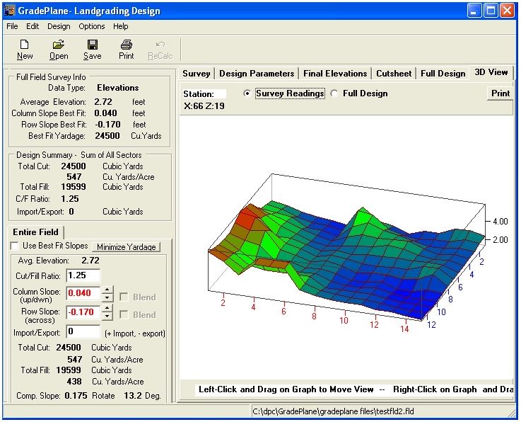
GradePlane LandGrading Design Software  is for Land Levelers and farmers and provides an easy way to design and output cut/fill maps for grading land to specified slopes. There are no complicated engineering terms to understand and survey data entry is in a convenient spreadsheet.


GradePlane


GradePlane 
Features:

  • Specify Row and Cross slopes, Cut/Fill Ratio
  • Field Size:  100 Rows by 100 Columns, variable grid size.
  • Survey Data Entry in Rod Readings or Elevations
  • Convenient spreadsheet for data entry and import data files
  • Plane Method of Field Design
  • Automatic Best Fit Design based on field Row and Cross slope trends and find slopes that minimize cut yardage.
  • Take advantage of natural field slopes and Design Fields with up to Seven Sectors and blend (hinge) slopes at break lines
  • Import yardage from outside the field or export yardage for construction projects.
  • Force design plane to a specified elevation
  • 3D Graphics view of designs and surveys
  • Multiple Printed Maps:  Cutsheet, Full Design Information, Survey and Graphs.
  • Work with a Full Field Design and Sector Design Simultaneously and compare results
  • Check Cut/Fill Ratios as work progresses.
  • Gradeplane now allows any station to be flagged as a partial station
Software

Price: 0 $

Price Currency: $

Operating System: Windows

Application Category: Civil Engineering

Editor's Rating:
5

Latest update

December 27, 2025

License Price

Price on Request

OS

Windows

Reviews

There are no reviews yet.

Be the first to review “GradePlane LandGrading Design 1.80”

Your email address will not be published. Required fields are marked *

Recommended for You