
Latest update
License Price
OS
MudShark developed by BrightBox, is a specialized earthworks estimation and site analysis software. It streamlines the process of calculating bulk earthworks volumes by allowing users to quickly capture plan contours, trace structures, and define existing and proposed ground levels. The software is built to simplify complex site analysis, provide precise cut-and-fill calculations, and generate visual 3D models for bidding, planning, and project management in construction and land development.
MudShark is an earthworks estimating software designed for Construction Estimators, Earthworks Contractors, Civil Engineers, Land Surveyors, Project Managers, and Site Developers who need to perform fast, accurate cut-and-fill calculations, generate earthworks takeoffs, and create 3D site models from 2D plans or drone data.
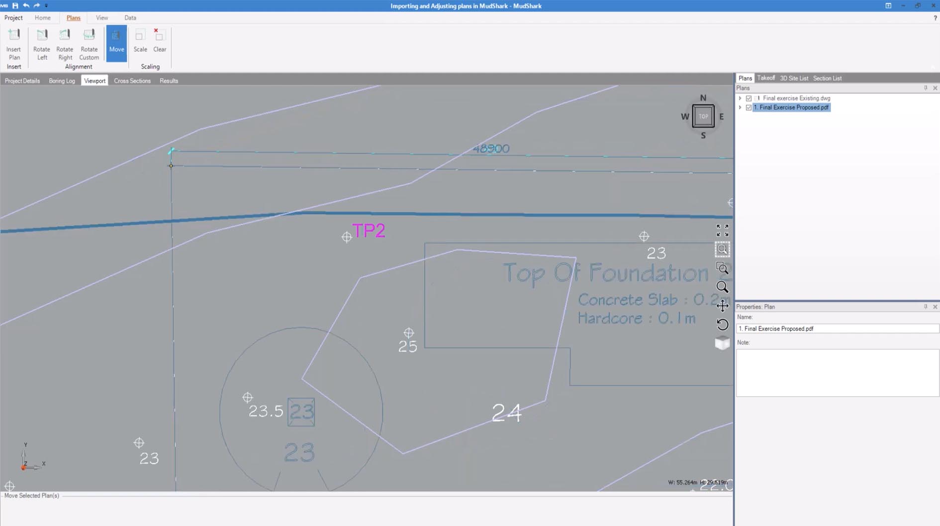
One-Click Contour Capture: Automatically extracts and interprets contour lines from 2D CAD plans (DWG, DXF) or PDFs for rapid model setup.
Advanced Cut & Fill Calculations: Performs precise volume calculations between existing and proposed surfaces using versatile takeoff tools and triangulated irregular networks (TINs).
Drone Data Import & Integration: Directly imports point cloud data and surfaces from drone surveys (e.g., from DJI, Pix4D, etc.) to create accurate existing terrain models.
3D Site Visualization & Modeling: Generates interactive 3D visualizations of the site, including proposed designs, stockpiles, and haul roads for better project understanding and client presentations.
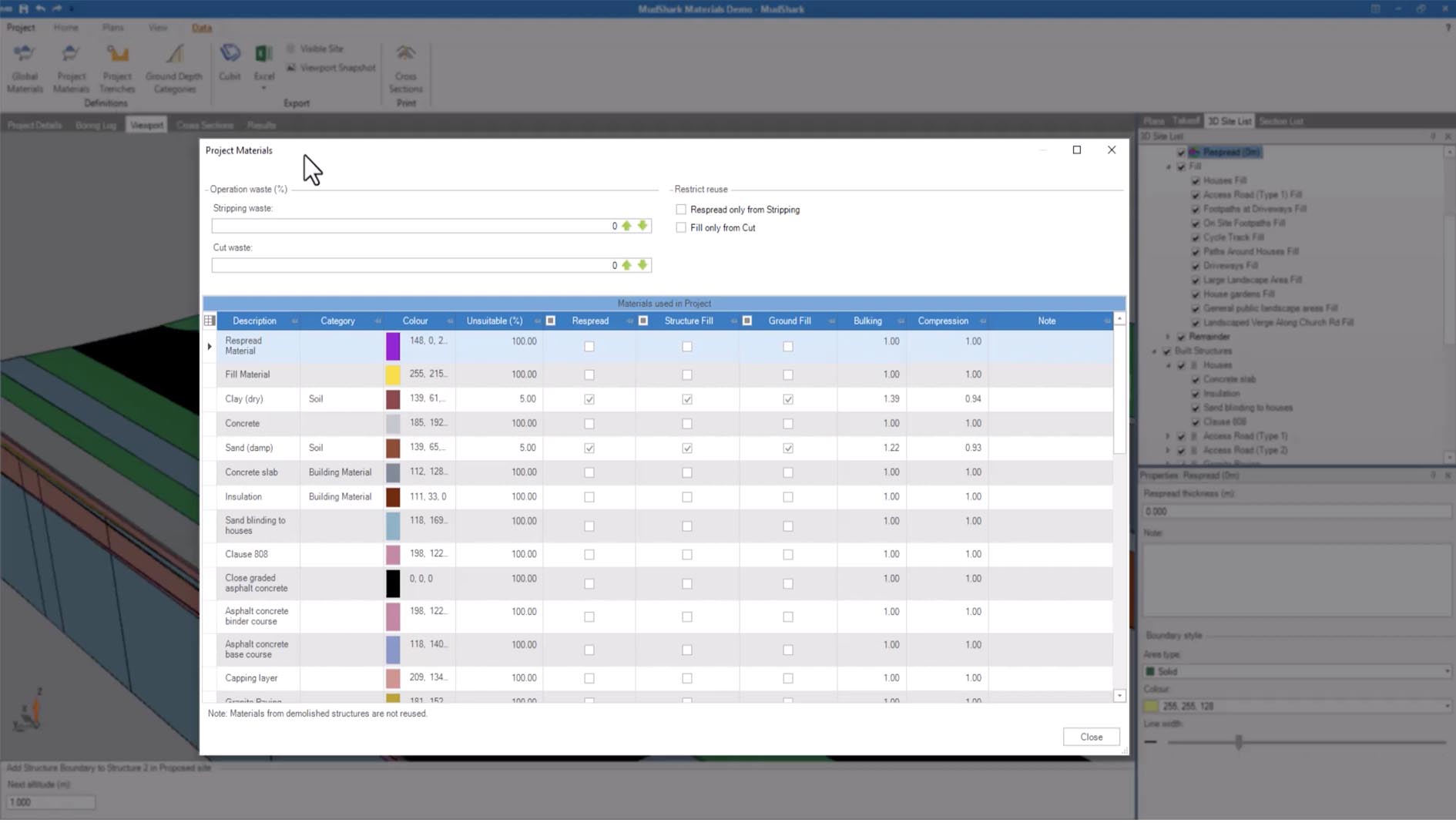
Unlimited Projects & Flexible Takeoff Tools: Supports an unlimited number of projects with tools to trace pads, buildings, trenches, and other site features for detailed quantity takeoffs.
Reporting & Export: Generates detailed reports with cut/fill volumes, material summaries, and exports data to spreadsheets or other estimating software.
This update focuses on enhanced data processing, improved user experience, and expanded integration capabilities.
Enhanced Drone Data Processing Engine: Faster and more accurate processing of large LiDAR and photogrammetry datasets from drones for creating high-resolution existing ground models.
Improved CAD File Compatibility: Better handling of complex layers and Xrefs in AutoCAD drawings for smoother import and contour recognition.
Streamlined User Interface & Workflow: Redesigned toolbar and project navigation for more intuitive earthworks takeoff and model editing.
Expanded Reporting Templates: New and customizable report formats for different client and contractual requirements.
Performance Optimizations: Faster calculation times for large, complex sites with millions of data points.
OS: Windows 10 or 11 (64-bit).
CPU: Multi-core Intel i5/i7 or equivalent (recommended for processing drone data).
RAM: 8 GB minimum (16 GB+ recommended for large drone datasets).
Graphics: Dedicated graphics card (NVIDIA or AMD) with 2GB+ VRAM for smooth 3D visualization.
Storage: Fast SSD with sufficient space for project files and imported data.
Price: 285 $
Price Currency: $
Operating System: Windows
Application Category: Civil Engineering
Latest update
License Price
OS


Reviews
There are no reviews yet.