nanoCAD 3DScan is a specialized module within the nanoCAD platform dedicated to working with 3D point cloud data. It provides a comprehensive set of tools for handling massive datasets (billions of points) from terrestrial and mobile scanners. Users can clean, filter, segment, and extract geometric primitives (planes, cylinders, spheres) from the point cloud to generate vector drawings, 3D meshes, and surfaces directly within a familiar CAD environment, bridging the gap between reality capture and design.
nanoCAD 3DScan is developed for surveyors, civil engineers, architects, industrial designers, and reverse engineering specialists. It is specifically designed for professionals who need to import, process, register, and model 3D data from laser scanners (LiDAR) and photogrammetry to create accurate CAD models, as-built documentation, and conduct measurements from point clouds.
Massive Point Cloud Import & Management: Supports major formats (E57, LAS, LAZ, PTS, PTX, XYZ). Efficiently handles and visualizes billions of points with dynamic level-of-detail (LOD) rendering.
Advanced Point Cloud Processing: Tools for filtering noise, decimating (reducing point density), cropping, and colorizing point clouds based on intensity or RGB values.
Scan Registration & Georeferencing: Align multiple scans into a single coordinate system using targets, cloud-to-cloud registration, or by importing external transformation data.
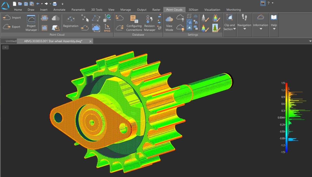
Direct CAD Modeling from Point Clouds: Extract 2D cross-sections, polylines, and 3D solid objects (walls, pipes, beams) by fitting geometric primitives (plane, cylinder, sphere) to point data.
Measurement & Analysis: Perform accurate distance, angle, area, and volume measurements directly on the point cloud. Compare the as-built point cloud to a design model for deviation analysis.
Seamless Integration with nanoCAD Platform: Works as a fully integrated module within nanoCAD Pro, allowing point clouds to be referenced alongside standard 2D/3D CAD geometry in DWG files.
Rendering & Presentation: Apply realistic shading and lighting to point clouds for clear visualization and creating presentation views.
The 2025 release focuses on improved performance, new AI-assisted tools, and enhanced interoperability:
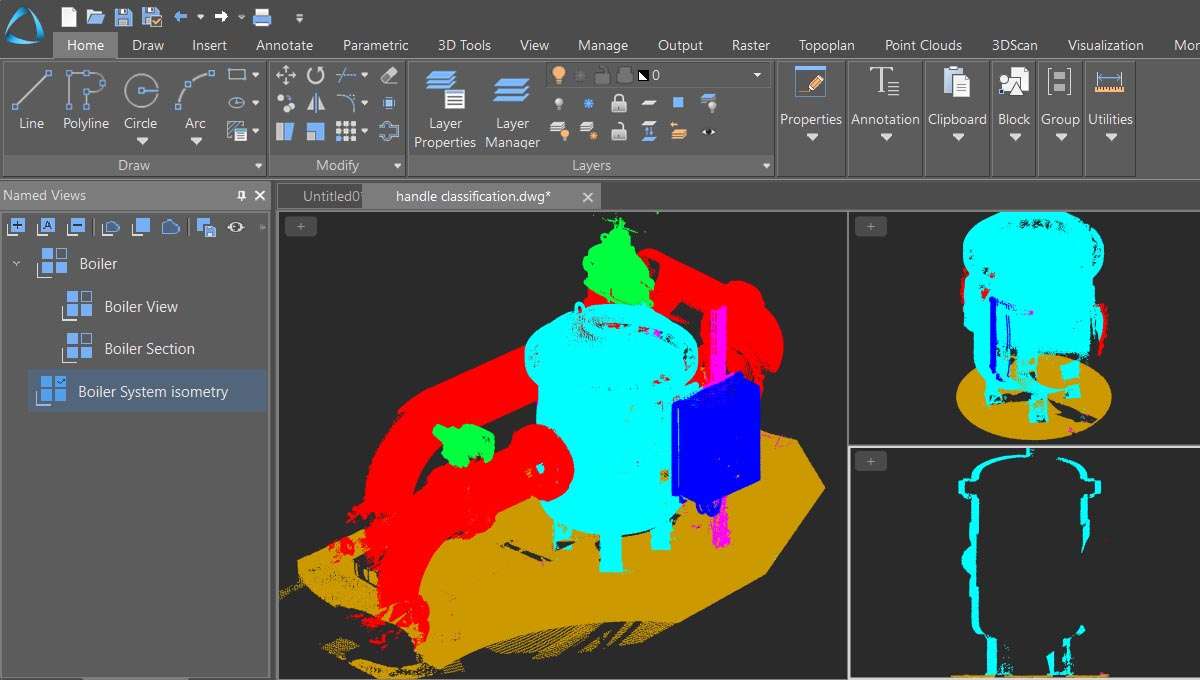
AI-Powered Point Cloud Classification (Beta): New machine learning algorithms to automatically classify points into common categories (Ground, Vegetation, Building, Pipework) to speed up data segmentation.
Enhanced Reality Mesh Support: Improved import and handling of textured 3D meshes from photogrammetry (OBJ, FBX) alongside traditional point clouds.
Faster Rendering & Navigation Engine: A new display engine utilizing modern GPU capabilities (OpenGL 4.5+) for smoother pan, zoom, and orbit of ultra-dense point clouds.
Streamlined Workflow for Civil & Plant Design: New toolkits and templates tailored for extracting topography (DTM) from scan data and modeling piping & instrumentation from industrial point clouds.
Expanded Import/Export Format Support: Added support for newer versions of industry-standard formats and better integration with UAV (drone) survey software outputs.
OS: Windows 10 (64-bit)
CPU: Intel Core i5 or AMD equivalent (4th generation or newer with SSE4.2)
RAM: 8 GB
GPU: DirectX 11 compatible graphics card with 2 GB VRAM
Display: 1920 x 1080 resolution
Price: 125 $
Price Currency: $
Operating System: Windows
Application Category: Surveying


Reviews
There are no reviews yet.