
Latest update
License Price
OS
nanoCAD GeoniCS is a comprehensive surveying and geospatial CAD software built on the nanoCAD platform. It integrates a full suite of tools for importing, processing, analyzing, and visualizing geodetic data. The software is tailored to automate the workflow from raw field measurements (from total stations, GNSS, or laser scanners) to finished maps, cross-sections, volume calculations, and technical documentation compliant with industry standards.
nanoCAD GeoniCS 2024 v24.1 is a specialized CAD platform designed for Surveyors, Topographers, Geodesists, Civil Engineers, Cartographers, and GIS Technicians who require professional tools for processing field survey data, creating topographic plans, generating digital terrain models (DTMs), and producing cartographic output.
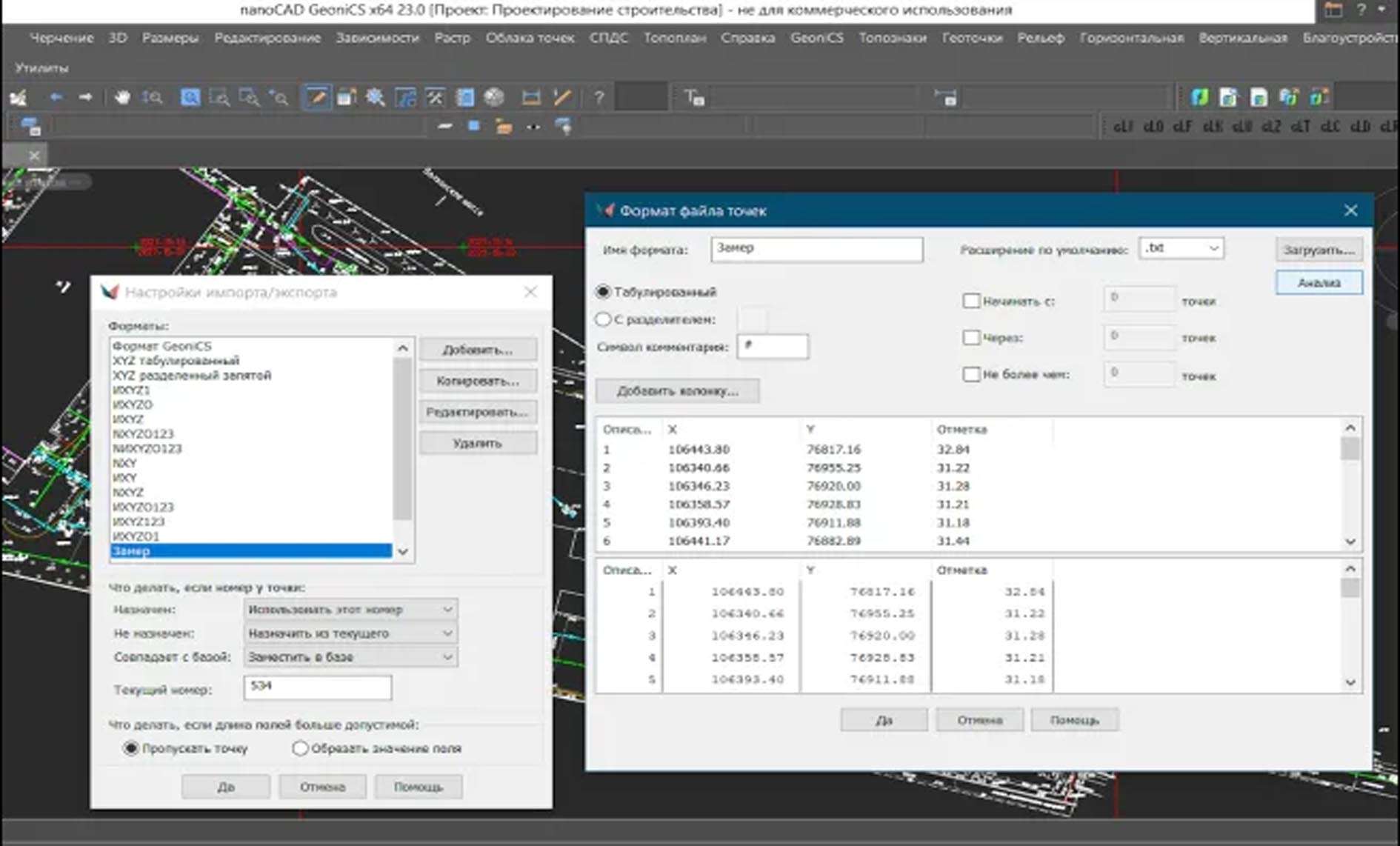
Field Data Import & Processing: Direct import of data from major total station and GNSS receiver brands. Tools for traverse adjustment, coordinate transformations, and geodetic calculations.
Digital Terrain Modeling (DTM): Powerful engine to create Triangulated Irregular Networks (TINs) from points, contour lines, or breaklines. Perform terrain analysis, generate contour maps, and calculate cut/fill volumes.
Automated Map Creation: Intelligent tools for creating topographic plans, including automatic symbol placement for standard topographic features, annotation, and layer management.
Cross-Section & Profile Generation: Automatically generate longitudinal and cross-sectional profiles from a DTM along any defined alignment, with detailed earthwork calculations.
Parcel & Cadastre Management: Tools for creating and managing land parcels, calculating areas, and generating cadastral plans with legal annotations.
GIS Integration & Data Exchange: Strong support for importing/exporting SHP, DXF, DWG, LandXML, and other standard formats, facilitating seamless work with GIS databases and other engineering software.
This annual release focuses on modernization, performance, and expanded data source support.
Modernized User Interface: Updated ribbon interface and dark theme support, aligning with contemporary CAD application standards for improved usability.
Enhanced Point Cloud Support: Improved tools for processing and classifying large LiDAR point clouds (.LAS, .LAZ) directly within the software for terrain extraction and 3D modeling.
New GNSS Processing Tools: Added support for processing data from a wider range of modern GNSS receivers and enhanced network RTK/post-processing workflows.
Performance & Stability: Optimized algorithms for handling massive datasets and faster rendering of complex DTMs and maps.
Expanded Reporting Templates: New customizable report templates for survey reports, volume statements, and coordinate lists that meet various regional standards.
OS: 64-bit Microsoft Windows 10 or 11.
CPU: 2 GHz or faster multi-core processor (Intel Core i5/i7 or equivalent recommended).
RAM: 8 GB minimum (16 GB or more recommended for large DTMs/point clouds).
Graphics: DirectX 11 compatible graphics card with 2 GB dedicated VRAM.
Storage: 5 GB free disk space for installation.
Price: 125 $
Price Currency: $
Operating System: Windows
Application Category: Geospatial
Latest update
License Price
OS


Reviews
There are no reviews yet.