
Latest update
License Price
OS
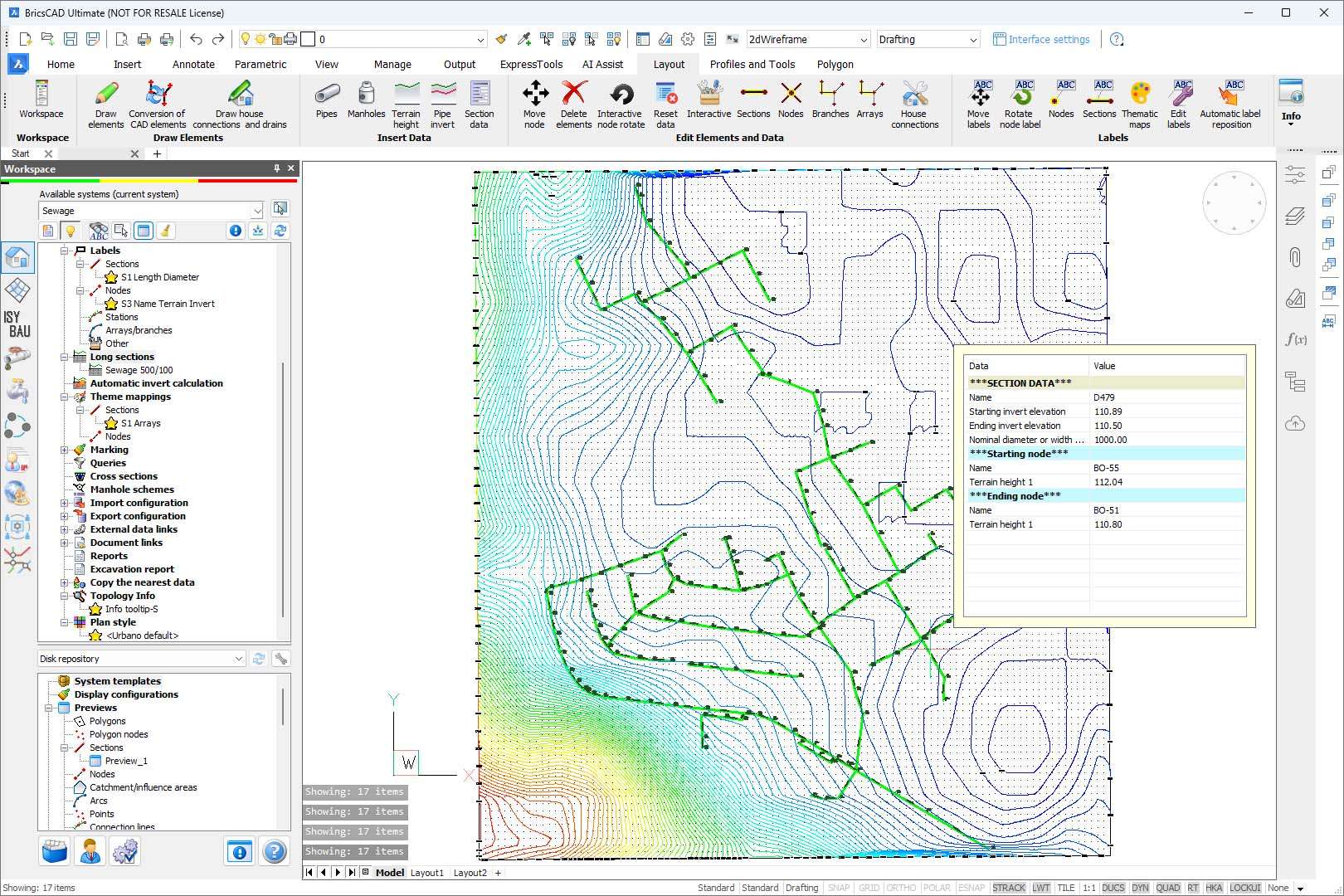
Design of water supply, sewage, and drainage networks
Softplan offers specialized functions that cover all needs in the design process of water supply, sewage and drainage networks.
Softplan works on 64-bit versions of BricsCAD Pro V21 – V23
Softplan combines standard engineering approach with modern design requirements.
It is possible to work with elements both in plan and in profiles, use digital terrain models, display elements in 3D, import the existing networks from GIS file formats and databases. When a certain design phase is over, it is possible to export the elements to widely-used BIM formats and to GIS databases.
The project is saved as a standard DWG file. This makes it easy to create backups, share projects, and edit.
Designers can:
Softplan helps develop alternative project scenarios and select the optimal solution.
It offers a wide range of tools for searching, filtering, sorting, comparing and graphically displaying data, which makes data analysis easier and faster. Advanced tools can be used for crossing analysis with parcels, intersection analysis with existing infrastructure, and functional network analysis.
Interactive tables facilitate a detailed inspection of each pipe and manhole by enabling:
Softplan includes both design functions and modules for the calculation of water supply, sewage, and drainage systems. It allows the display of results throughout the program, including labels, tables, profiles, and reports. With the module Sewplan, the user can run hydraulic calculation and pipe sizing for sanitary and storm sewers, while with the module Wetplan, they can run hydraulic calculation and pipe sizing of water supply networks. They can also export the network created with Softplan, and use some other hydraulic software for hydraulic calculation and analysis.
Definition of functional network elements (reservoirs, pumps, valves, water tanks…)
Hydraulic calculation of water distribution networks
Optimization of pipe diameters by genetic algorithms according to given parameters
Definition of water demands
Definition of catchment areas
Various methods for calculation and pipe sizing of gravity, vacuum and pressure pipelines
Various methods for the calculation of storm and sanitary flows
Softplan software integrates functions for the design, import of GIS data and hydraulic modeling, and is part of the BIM process for the infrastructure design.
The ability to work with a large amount of project data is crucial for any major project. It is even more important to be able to quickly edit the data in previous versions of the project and documentation, especially for projects that are being developed over a longer period of time.
Softplan provides cutting-edge tools for both tasks.
Modern tools are available for:
Price: 385 $
Price Currency: $
Operating System: Windows
Application Category: Architecture
Latest update
License Price
OS


Reviews
There are no reviews yet.