

Latest update
License Price
OS
GVERSE GeoGraphix 2026 is a geological interpretation suite developed by Halliburton for the oil and gas exploration and geosciences sectors. It provides integrated workflows essential for petrophysical analysis, with applications demonstrated in well log data analysis for enhanced reservoir understanding. The software is designed for geoscientists, offering capabilities in integrated workflows for petrophysics, geomodeling, geophysics, and field planning.
GVERSE GeoGraphix 2026, developed by Halliburton, serves as a pivotal interpretation suite within the oil and gas exploration and geosciences industries. The software is engineered to consolidate critical geological, geophysical, and petrophysical analysis functionalities into a single platform. This integration allows geoscientists to streamline complex workflows, from initial data appraisal to detailed field planning, directly contributing to more informed exploration decisions in sectors like upstream oil and gas operations.
GVERSE GeoGraphix consolidates multiple analytical disciplines into an integrated environment, providing geoscientists with essential tools for comprehensive interpretation. The suite includes specialized applications designed to work in concert:
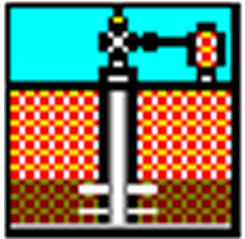
The Field Planner application within GVERSE GeoGraphix is designed to assist geoscientists and engineers in the strategic layout and optimization of exploration and production assets. It employs specific algorithms to determine optimal well locations and configurations, considering geological constraints and production objectives. This feature supports efficient field development by optimizing spatial arrangements of wells and infrastructure.
Leveraging its Pro 3D capabilities, GVERSE GeoGraphix enhances data visualization and model interpretation. This feature allows users to interact with detailed 3D representations of geological models and seismic data. Effective 3D visualization aids in identifying subtle geological features, understanding structural complexities, and validating interpretations, thereby improving decision-making processes.
GVERSE GeoGraphix is part of a broader ecosystem of software solutions from Halliburton’s Landmark Graphics. It is designed to integrate seamlessly with other tools in the Landmark suite, such as OpenWorks for data management and Drillworks for advanced geological interpretation. This interoperability ensures that data flows efficiently between applications, supporting end-to-end workflows and enhancing the overall productivity of geoscientific teams.
Geoscientists utilize GVERSE GeoGraphix in various operational contexts within the oil and gas industry. For instance, a geophysicist might employ the seismic interpretation tools to identify potential drilling targets by analyzing subsurface structures from seismic surveys. Concurrently, a petrophysicist could use the well log analysis modules to evaluate the hydrocarbon potential of identified formations, integrating findings from both seismic and well data.
Furthermore, in field development planning, teams can use the integrated geomodeling and field planning features to design efficient well patterns that maximize reservoir contact and minimize operational costs. The software’s ability to combine detailed subsurface understanding with strategic field layout makes it a valuable asset throughout various stages of exploration and production.
GVERSE GeoGraphix offers a comprehensive suite of tools explicitly tailored for the oil and gas sector, enabling detailed petrophysical and geophysical analysis. Unlike other geological software, it provides a seamless integration of field planning, log analysis, and 3D visualization, making it particularly advantageous for geoscientists working on multidisciplinary projects.
GVERSE GeoGraphix includes powerful 3D visualization and intuitive functionalities for seismic interpretation, allowing geoscientists to handle both basic and advanced interpretation tasks effectively. The system facilitates end-to-end workflows that enhance the accuracy and efficiency of seismic analyses.
GVERSE GeoGraphix integrates seamlessly with other Landmark software tools such as OpenWorks and Drillworks, enhancing capabilities in data management and geological interpretation. This interoperability allows users to leverage additional functionalities, streamlining workflows across different geological tasks.
Price: 0 $
Price Currency: $
Operating System: Windows
Application Category: Oil & Gas Engineering
Latest update
License Price
OS


Reviews
There are no reviews yet.