

Latest update
License Price
OS
NeuraMap 2022.1 is an automated map digitizing software developed by NeuraSoft. It offers automated tracing capabilities using neural networks, primarily serving the geoscience, environmental consulting, and oil & gas industries. This software is utilized by geoscientists to calculate reservoir volumetrics and reserves from both hand-drawn and digital maps, providing accurate data capture for complex geospatial information.
NeuraMap is a specialized geospatial software designed to streamline the process of map digitization and analysis. Developed by NeuraSoft, it leverages advanced neural network technology to accurately convert raster maps into usable vector data. This capability is essential for geoscientists who need to analyze and quantify features from various map sources, including legacy hand-drawn geological surveys and scanned topographical maps.
The core of NeuraMap’s functionality lies in its automated map digitizing engine, which incorporates neural networks for tracing map elements. This technology enables the software to intelligently identify and capture lines, curves, and other map features from scanned documents with a high degree of accuracy. By automating these complex tracing tasks, NeuraMap significantly reduces the manual effort typically required for map conversion.
Key aspects of its automated digitizing capabilities include:
NeuraMap provides robust tools for capturing detailed spatial information and ensuring the quality of the digitized output. The software supports the capture of intricate line and curve data, which is crucial for accurate geological mapping. Built-in quality control mechanisms help users verify the integrity of the data throughout the digitizing workflow, allowing for the identification and correction of potential errors.
Features that support data quality include:
For professionals in the oil and gas sector, NeuraMap offers specialized functionality for reservoir volumetrics and reserves calculation. The software can process digitized geological maps to derive critical volumetric data, supporting more accurate resource estimation. This feature directly aids geoscientists in quantifying reserves and understanding reservoir characteristics from both existing and new geological interpretations.
Effective map digitization in geoscientific applications relies heavily on precise calibration, and NeuraMap addresses this with its intelligent calibration wizard. This wizard simplifies the process of setting up accurate geographic references for scanned maps, ensuring that digitized data aligns correctly with real-world coordinates. The software’s ability to integrate diverse data sources and formats is also a critical component of its utility, facilitating seamless incorporation into broader geospatial workflows.
NeuraMap ensures broad compatibility by supporting a range of industry-standard file formats for both import and export. This includes raster formats commonly used in image processing and vector formats essential for GIS analysis. The software’s export options are designed to facilitate easy data sharing and integration with other GIS and geological software packages.
Key supported exports include:
In geological surveys, NeuraMap aids in the digitization of historical geological maps and survey data. This process is vital for creating comprehensive digital geodatabases that can be used for further analysis, such as identifying potential mineral or hydrocarbon deposits. The automated tracing capabilities significantly speed up the conversion of these often complex, hand-drawn survey documents into accurate digital representations.
For environmental consulting projects, NeuraMap assists in analyzing and digitizing topographical maps and environmental zone maps. This facilitates the assessment of land use, hydrological patterns, and potential environmental hazards. By converting complex visual data into precise geospatial information, the software supports informed decision-making for land management and remediation efforts.
NeuraMap can export data in several industry-standard formats including GeoTIFF and various vector formats. This flexibility is crucial for ensuring compatibility with other software used in geoscience, thereby facilitating the integration of digitized maps into larger datasets and workflows.
NeuraMap employs advanced automated data capture techniques, alongside multiple calibration methods, to ensure the accuracy and quality of the digitized output. The system can generate reports on data quality parameters, helping users identify and rectify any discrepancies in their work.
NeuraMap is particularly beneficial for geoscientists in scenarios requiring the digitization of hand-drawn or scanned topographical maps for analysis or presentation. Its capacity for rapid volumetric calculations further enhances its value in the oil and gas sector where accurate reservoir estimates are crucial.
Price: 0 $
Price Currency: $
Operating System: Windows
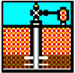
Application Category: Oil & Gas Engineering
Latest update
License Price
OS


Reviews
There are no reviews yet.